Mt. McLoughlin Hiking
On A Klamath Vacation

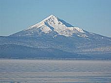
A Mt. McLoughlin hiking experience I'll never forget was accomplished in 1998. It was a goal I set for myself after attending the Dale Carnegie course. It wasn’t an easy goal to accomplish since it was at an elevation of 9,495 feet and I wasn’t getting any younger. So I invited a group of guys to join me and we set a date to climb the mountain in August. (August and September are the best months to climb this summit.)
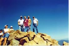
 The climb to this summit is a favorite of many in the region around the mountain and many people climb it at least once a year. I know several families who climb it as a family outing. It’s also a favorite group activity and it’s fun to have a group picture at the top. There are others who try to see how many times they can climb it in a day. I know of one person who ran up and down the mountain in three hours and then decided to do it again.
A Northwest Forest Pass is required for going on the Mt. McLoughlin hiking trail. The fee is $5 per day or $30 for an annual pass. Passes may be purchased at any Forest Service Office in the area.
 For me the climb was an arduous one – taking 5 and a half hours to go up, an hour at the top, and 3 and a half hours coming down. We arrived at the parking area around 7 a.m. to make sure we had plenty of time to reach the summit and return. When I finished my leg muscles were throbbing and I didn’t know if I could drive home or not. Despite the agony it is still a favorite memory and will always be my favorite “mountain-top” experience!
Be sure to take plenty of water, snacks, a lunch, and a light jacket or sweatshirt. A wide-brimmed hat and sunscreen should also be included. Plan on taking more than you need especially since you don’t know how long it will take you. It is also a good idea to have a cell phone or other communication device just in case you get lost.
The trail starts out like any normal trail and gradually increases in altitude. And the higher you get the views get more spectacular. You pass the timber line and then you get to what you think is a clear view of the summit and you think to yourself that this hike won’t be as bad as you had imagined.
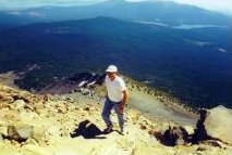
Then when you reach the “summit” it’s not the summit at all but the base of the basin on the east side of the mountain. From this vantage point you see the real summit and you wonder if you have the strength and energy to make it. The last segment of the trail is not clearly marked and you need to be careful because the rock is slippery. So follow the ridge line all the way to the top.

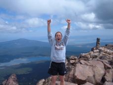
It is not an uncommon thing when you reach the summit to reach your arms in the air and scream “I made it!” Be sure to take plenty of pictures as the views are incredible. You’ll be surprised at how many other people are there too and it’s not hard to find someone who’ll take a group picture.
From this vantage point you can easily see Fourmile Lake. To the south is Lake of the Woods and a little further west is Fish Lake.
Click here for more information about camping at Fourmile Lake and Lake of the Woods.
The climb down can be a little tricky because the path is not clearly marked. At least once or twice a year hikers get lost coming down and search parties are sent looking for them. Once you do find the Mt. McLoughlin hiking trail you seem to walk an endless time and you start to think you are lost – but keep going. The trail ends at the parking lot and you are exhausted and relieved and can’t wait until you get home and can take a nice long hot shower.
 The Mt. McLoughlin hiking trail can be reached by traveling about 38 miles west of Klamath Falls on Hwy 140. Take a right at the Fourmile Lake turnoff and travel about 3 miles to the junction with Forest Service Road 3650. Turn left and go one quarter mile to the trailhead.
Return to Home Page from McLoughlin Hiking Page.
|